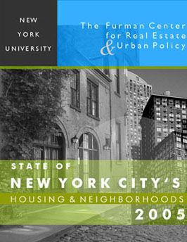
State of New York City’s Housing & Neighborhoods – 2005 Report

Download the report
PDF, 3 MB
The Furman Center is pleased to present the 2005 edition of the State of New York City’s Housing and Neighborhoods. Every year the Furman Center compiles statistics on housing, demographics and quality of life in New York City’s neighborhoods from a variety of sources.
This edition streamlines the presentation to focus attention on the critical data that reveals how the City, its five boroughs, and its 59 community districts, have fared in recent years. It shows how each of the City’s neighborhoods is progressing, both in absolute terms and in relation to other areas of the City. It provides the first independent analysis of the just-released results of the 2005 Housing and Vacancy Survey. Finally, it adds a chapter analyzing how the affordability and availability of housing has changed between 2002 and 2005.
You can access our Focus Chapter and Citywide Data in the PDF files below. For a copy of the full report, email furmancenter@nyu.edu.
- Front Matter Acknowledgments and Table of Contents
- Overview Introduction to the 2005 Edition and a summary of key findings
- Recent Trends in Affordability and Availability of Housing In New York City
- Notes on the 2005 Edition Geographic definitions, ranking information, and a look at what’s new in the State of NYC’s Housing and Neighborhoods 2005
- Indicators Data indicator definitions, source information, and geography and year for which data is available. This section also provides rankings for each indicator, showing the neighborhoods that have the highest and lowest totals.
- New York City Data and analysis of trends on New York City as a whole
- The Bronx Data and analysis of trends on the Bronx and its twelve community districts
- Brooklyn Data and analysis of trends on Brooklyn and its eighteen community districts
- Manhattan Data and analysis of trends on Manhattan and its twelve community districts
- Queens Data and analysis of trends on Queens and its fourteen community districts
- Staten Island Data and analysis of trends on Staten Island and its three community districts
- Appendix This section includes a description of our data methods and pages about NYCHANIS, PlanNYC, the Furman Center and an index of the Community Districts.
The data for each community district may be downloaded as an individual PDF file below.
Bronx
- Mott Haven/ Melrose 101 (84 KB)
- Hunts Point/Longwood 102 (83 KB)
- Morrisania/Crotona 103 (83 KB)
- Highbridge/Concourse 104 (82 KB)
- Fordham/University Heights 105 (82 KB)
- Belmont/East Tremont 106 (83 KB)
- Kingsbridge Heights/ Bedford 107 (83 KB)
- Riverdale/Fieldston 108 (82 KB)
- Parkchester/Soundview 109 (83 KB)
- Throgs Neck/Co-op City 110 (85 KB)
- Morris Park/Bronxdale 111 (83 KB)
- Williamsbridge/Baychester 112 (82 KB)
Brooklyn
- Astoria 401 (82 KB)
- Woodside/Sunnyside 402 (82 KB)
- Jackson Heights 403 (82 KB)
- Elmhurst/Corona 404 (82 KB)
- Ridgewood/Maspeth 405 (83 KB)
- Rego Park/Forest Hills 406 (83 KB)
- Flushing /Whitestone 407 (83 KB)
- Hillcrest/Fresh Meadows 408 (83 KB)
- Ozone Park/Woodhaven 409 (83 KB)
- S. Ozone park/Howard Beach 410 (84 KB)
- Bayside/Little Neck 411 (83 KB)
- Jamaica/Hollis 412 (85 KB)
- Queens Village 413 (84 KB)
- Rockaway/Broad Channel 414 (83 KB)
Staten Island
- St. George/Stapleton 501 (81 KB)
- South Beach/Willowbrook 502 (82 KB)
- Tottenville/Great Kills 503 (80 KB)
Manhattan
- Financial District 301 (84 KB)
- Greenwich Village/Soho 302 (83 KB)
- Lower East Side/ Chinatown 303 (82 KB)
- Clinton/Chelsea 304 (83 KB)
- Midtown 305 (83 KB)
- Stuyvesant Town/Turtle Bay 306 (83 KB)
- Upper West Side 307 (77 KB)
- Upper East Side 308 (77 KB)
- Morningside Heights/Hamilton 309 (83 KB)
- Central Harlem 310 (77 KB)
- East Harlem 311 (83 KB)
- Washington Heights /Inwood 312 (82 KB)
Queens
- Greenpoint/Williamsburg 201 (83 KB)
- Fort Greene/Brooklyn Heights 202 (83 KB)
- Bedford Stuyvesant 203 (85 KB)
- Bushwick 204 (85 KB)
- East New York/Scarrett City 205 (81 KB)
- Park Slope/Carroll Gardens 206 (84 KB)
- Sunset Park 207 (83 KB)
- Crown Heights 208 (84 KB)
- South Crown Heights/Prospect hts 209 (82 KB)
- Bay Ridge/Dyker Heights 210 (82 KB)
- Bensonhurst 211 (82 KB)
- Borough Park 212 (84 KB)
- Coney Island 213 (84 KB)
- Flatbush/Midwood 214 (83 KB)
- Sheepshead Bay 215 (86 KB)
- Brownsville 216 (83 KB)
- East Flatbush 217 (84 KB)
- Flatlands/Canarsie 218 (85 KB)


